
Got streambank or gully erosion problems? Concerned about sediment or nutrient loss? Interested in getting a nutrient management or conservation plan for your farm? Our staff will provide assistance to help address your concerns.

For more information, please call Rock Island County NRCS/SWCD office at (309) 764-1486 X 3 or email:
SWCD Resource Conservationist - Rich Stewart: rstewart@rockislandswcd.org OR
SWCD Conservation Specialist - Joe Gates: joe.gates@il.nacdnet.net
Upland Practices Eligible
GRASSED WATERWAY:
Broad, shallow, shaped channels designed to carry surface water across farmland without causing soil erosion.
WATER AND SEDIMENT CONTROL BASIN (WASCOB):
A short earthen dam built across a minor watercourse to form a sediment trap.
DENTRIFYING BIOREACTOR:
A buried trench filled with wood chips installed at the edge of a field at the end of a tile line that filters nitrogen from tile water. More info click here.
GRADE STABILIZATION STRUCTURES - DRY DAM & PIPE DROP STRUCTURE:
Both have an earthen or concrete dam built across drainage ways to prevent gully erosion. Pipe outlet structures are typically used if the dam can temporarily hold most of the water from a storm. Drop structures are used for sites with minimal storage capacity.
SATURATED BUFFER:
A system with a control structure added to the outlet of an existing tile line that diverts a portion of the flow into a lateral distribution line under the buffer strip. The buffer strip is planted parallel to the creek. More info click here.
Streambank Practices Eligible
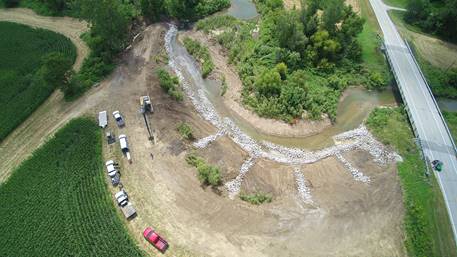
LONGITUDINAL PEAKED STONE TOE PROTECTION (LPSTP):
Stone placed across the toe of a bank. Typically, this is done in an area where erosion is a critical threat and continuous bank protection is needed.
STREAM BARBS:
Low profile sloping stone still angled upstream to help reduce bank erosion by re-directing currents away from the bank. Usually placed in a series of 2 or more around a bend to direct flow.
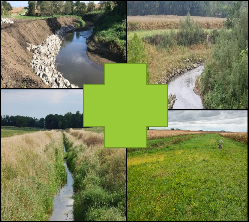
2-STAGE DITCHES:
Drainage ditches are modified by adding floodplain benches within the overall channel which mimic a natural floodplain zone. During high flows this allows the water to spread out and slow down, leading to greater channel stability.